"The Ragged Fringe of India's Sari"
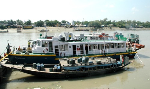
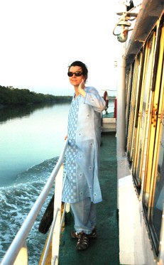
The bus from a still-deserted BBD Bag starts at 8:30am carrying a dozen of us extrepid implorers towards Sonakhali and Basanti. The road to Basanti from the EM Bypass was built using ADB funds and is quite good, if you can discount the lack of a median and the tendency of Indian traffic to straddle the middle of any road while traveling at breakneck speed. By noon we are at Sonakhali, ready to board the MV Madhukar, which will take us over the next two days down the Matla, the Vidya and other rivers deep into the Sunderbans.
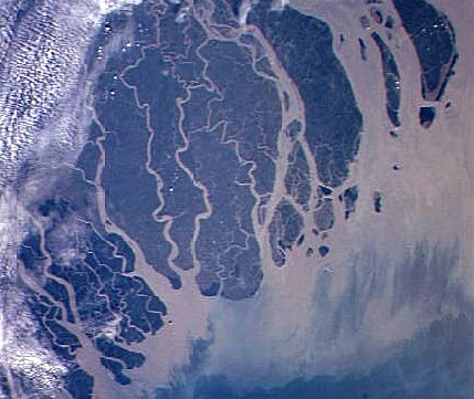
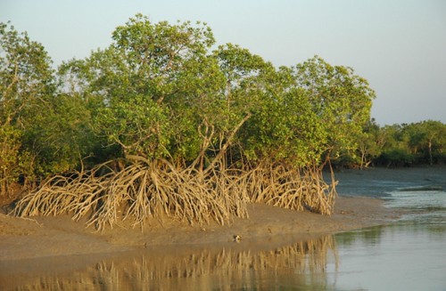
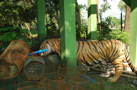
The area that makes up the Sunderbans National Park is the largest delta as well as the largest estuarine mangrove forest in the world. Its name comes from one of the mangrove plants known as the Sundari (Heritiera Minor) tree. The Sunderbans cover an area of 10,000 square kilometers out of which 4000 square kilometers are in West Bengal, the rest being in Bangladesh. The park is probably best known as a reserve of the Royal Bengal Tiger, of which about 230 individuals remain on the West Bengal side. This is the tide country, almost 70 percent of the 10,000 square kilometers of the park is submerged under water at some point of the day, and the altitude of the rest does not exceed a few meters above the sea level. Due to its beauty and richness of wildlife, it was declared a world natural heritage site by UNESCO in 1974.
The Sunderbans delta is cris-crossed by numerous tributaries of the mighty rivers Ganga and Brahmaputra and they empty silt from the subcontinent into the Bay of Bengal and the Indian Ocean. We will go down several major ones in the next few days – the Matla, the Vidya, the Gosaba. Very few carry fresh water, having been completely cut off from the main rivers due to silting and island formation. Most of these channels are maintained by the diurnal tidal flow, with tidal waves rising to a height of up to 7.5 m.
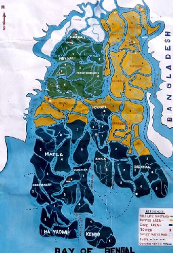
The area is divided into four administrative zones -- the core zone (i.e. the national park and the heritage site), an afforestation zone, an agri-operation zone and a restoration zone, but these are really constructs that exist only in the minds of the baboos, for “here there are no borders to divide fresh water from salt, river from sea, even land from water. The tides reach more than two hundred miles inland, and every day thousands of acres of mangrove forest disappear only to re-emerge hours later. For hundreds of years, only the truly dispossessed and the hopeless dreamers of the world have braved the man eaters and the crocodiles who rule there, to eke a precarious existence from the unyielding mud.“
(http://www.amitavghosh.com/books_html_indv.php?book_id=9)
We stop at Dobanki, Sudhanyakhali and Sajnekhali. Neither Dakshin Ray nor Dhona can be seen but there are many Dukheys in evidence. And also spotted deer, crocodiles, herons, olive ridley as well as river terrapin turtles.

0 Comments:
Post a Comment
<< Home